Following the links below, you can download grids of interpolated data 1km and 5km resolution for several continents, as well as software packages to query point locations. We provide historical climate normal periods, decadal averages, annual, seasonal and monthly data from 1901-present as well as multi-model CMIP6 climate projections for the 2020s, 2050s, 2080s on the pages below.
We also calculate a large number of derived variables of economic or biological relevance, such as drought indices, growing degree days, heating and cooling degree days, frost-free periods, etc. All together, more than 20,000 spatial coverages of climate variables can be downloaded and/or interactively queried for individual locations.
The methodological approaches used have shifted over time from thin-plate spines (Mexico & South America) to PRISM interpolations (North (America and Europe) to deep learning with neural networks (Africa). We are currently working on upgrading the South Amerca package to be based on interpolations with neural networks.
Climate data for North America
ClimateNA software & gridded dataPermanent link: http://tinyurl.com/ClimateNA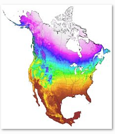 |
Climate data for Europe
ClimateEU software & gridded dataPermanent link: http://tinyurl.com/ClimateEU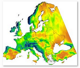 |
Climate data for Africa
ClimateAF software & gridded dataPermanent link: http://tinyurl.com/ClimateAF |
Climate data for South America
ClimateSA software (under development)Permanent link: http://tinyurl.com/ClimateSA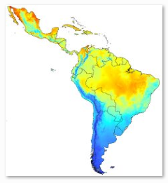 |
Depreciated datasets
Western North America
ClimateWNA software and 1km resolution gridsPermanent link: http://tinyurl.com/ClimateWNA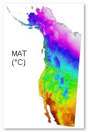 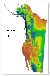 |
Western North America - Velocity
Velocity of climate change grids at 1km resolutionPermanent link: http://tinyurl.com/VelocityWNA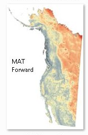 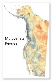 |
Climate data for Alberta
ClimateAB softwarePermanent link: http://tinyurl.com/ClimateAB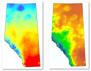 |
References


Software to query databases
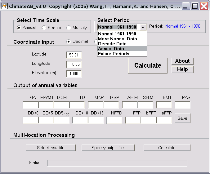
The user can input latitude, longitude, and elevation (optional) to generate up to 50 monthly, seasonal, and annual climate variables, including various chilling and growing degree days, frost free period, snow fall, dryness indices, etc. In addition, the user can generate or query thousands of spatial data coverages for historical time periods and future predictions, through time scale and time period selection from hierarchical drop down lists. The multi-location processing function can be used to process spreadsheets of coordinates or digital elevation models.
How it works
It is not practical to generate and distribute gridded climate data at very
high resolution. A typical gridded GIS data set with
10,000 observations for British Columbia at the resolution of 10km would
have 100 million observations at 100m resolution. Few users can handle such
data sets, yet such accuracy is often needed for temperature related climate
variables to determine, for example, the conditions of a sample site on a
mountain slope in forestry research.
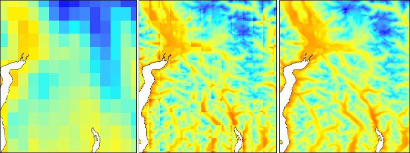
To solve this problem we use medium resolution climate data (2.5 arcmin or approximately 4km) and a software
solution to build a local and temporary scale-free climate model on top.
This model
is mainly
driven by the elevation difference between a location of interest and the
elevation used to calculate the climate variables of the medium resolution
data set at this point. GIS coverages of climate variables are generated from
a high-resolution DEM in a two-step process: by elevation adjustments (left
to middle) and by
bilinear interpolation to remove tile artifacts (middle to right).